Earthquake in Philippines (Jun 2026)
On 8 June 2026, a magnitude 7.8 earthquake struck the Mindanao region of the southern Philippines, near General Santos City and Sarangani Province. This recent publicly reported event may be useful for the GEP community as a starting point for EO data discovery, post-event change screening, deformation analysis, and workflow preparation. For public context, users can refer to the Disaster Charter activation page, the PHIVOLCS earthquake information bulletin, and the USGS event page.
For EO data discovery, Sentinel-1 acquisitions are a useful starting point for looking at surface change, coherence loss, and possible ground deformation patterns after the earthquake. Optical data, including Sentinel-2 where cloud-free scenes are available, may help with visual interpretation of landslides, coastal impacts, damaged infrastructure areas, or other visible post-event changes. Public geological and civil protection information should be used alongside EO-derived products to support careful interpretation.
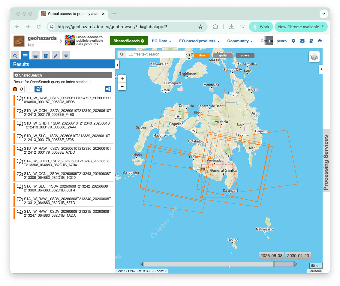
Data discovery on GEP
An initial Sentinel-1 search has been prepared around southern Mindanao, covering the Sarangani / General Santos area from the event date open this search in the GEP Geobrowser:
Relevant GEP services
These services may be useful starting points for preparing EO workflows around this event. This does not imply that they have already been run for the event.
- DInSAR — DInSAR Displacement Mapping — interferometric analysis from Sentinel-1 SLC pairs, including coherence, phase, and line-of-sight displacement products.
- SAR-COIN — Coherence and Intensity Composite — coherence and intensity composites to help highlight surface change or loss of coherence between SAR acquisitions.
- SAR-Change — SAR Amplitude Change — SAR amplitude change analysis between acquisitions, useful for event-driven change screening where SAR data are available.
- STACK — Co-located Stacking — co-location and stacking of multiple EO products for comparative multi-temporal or multi-sensor analysis.
A practical first step would be to review Sentinel-1 acquisitions before and after 8 June 2026, check whether the acquisition geometry supports coherence or deformation analysis, and then complement the SAR results with Sentinel-2 observations where cloud-free scenes are available. Public event information from PHIVOLCS and other official sources should be used to guide the area of interest and interpretation.
This topic is shared for community awareness, EO data discovery, and workflow preparation. It is not an official emergency response communication and does not imply that GEP produced public reference products or is providing operational emergency response support.