A severe weather event affected parts of the lower North Island of New Zealand in April 2026, including Wellington, Wairarapa, and the Tararua District. The event was linked to prolonged heavy rain, thunderstorms, and strong winds associated with a slow-moving low-pressure system connected to Cyclone Vaianu.

Image: Flood, Landslide, Storm in Island Bay, New Zealand, 24 April 2026. Source: Disaster Charter public event page. Licence: source/licence should be verified before publication. Credit: Disaster Charter public event page. Product shown as a public reference example, not as a GEP output.
Image: Flood, Landslide, Storm in New Zealand, 28 April 2026. Source: Disaster Charter public event page. Licence: source/licence should be verified before publication. Credit: Disaster Charter public event page. Product shown as a public reference example, not as a GEP output.
For public context, users can refer to the Disaster Charter activation page.
For EO data discovery, Sentinel-1 acquisitions are a useful starting point for flood-related analysis, especially where cloud cover may limit optical observations. Sentinel-2 imagery can still support visual interpretation and spectral-index analysis where clear scenes are available. Multi-temporal comparison and co-location of relevant datasets may also help users prepare a first screening of affected areas.
Data discovery on GEP
Users can start from the GEP Geobrowser to inspect available EO data before choosing a processing workflow. An initial Sentinel-1 search has been prepared for New Zealand from the event date:
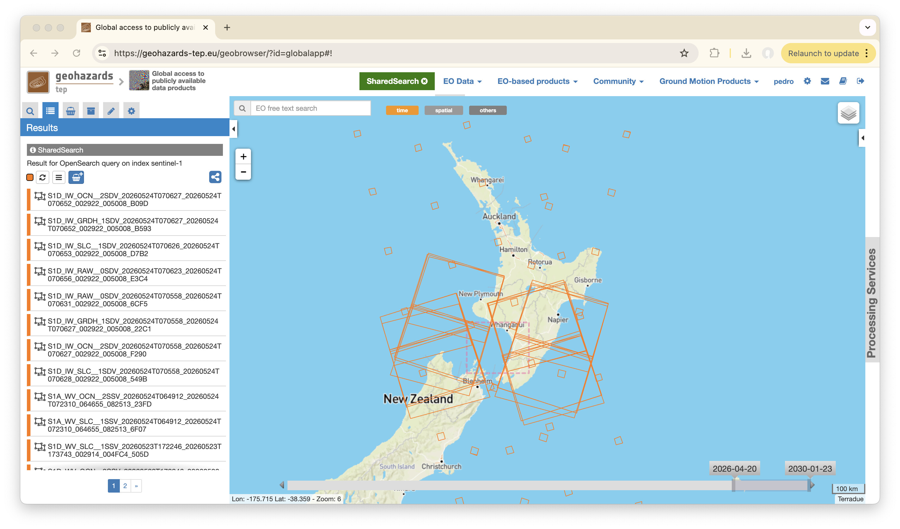 Image: Example GEP Geobrowser search results over the event area. Source: GEP Geobrowser screenshot prepared by the operator for this topic. Licence: source/licence should be verified before publication. Credit: GEP operator.
These services may be useful starting points for preparing EO workflows around this event. This does not imply that they have already been run for the event.
- SAR-Change — SAR Amplitude Change — SAR amplitude change analysis between acquisitions, useful for event-driven change screening where SAR data are available.
- SAR-COIN — Coherence and Intensity Composite — coherence and intensity composites to help highlight surface change or loss of coherence between SAR acquisitions.
- OPT-Index — Optical Spectral Index Generation — optical indices such as NDVI, NDWI, and NBR for surface, vegetation, water, and burn-related analysis.
- STACK — Co-located Stacking — co-location and stacking of multiple EO products for comparative multi-temporal or multi-sensor analysis.
A practical first step would be to refine the area of interest around the lower North Island, review Sentinel-1 acquisitions before and after 20 April 2026, and compare suitable image pairs for flood-related change. Where cloud-free optical scenes are available, Sentinel-2 products can be added to support visual interpretation and spectral-index analysis.
This topic is shared for community awareness, EO data discovery, and workflow preparation. It is not an official emergency response communication and does not imply that GEP produced any external reference material or is providing operational emergency response support.